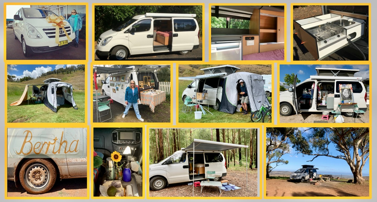
Bertha
I imagined spending ten days lazing around Hummocks' Station would be enough to shake off the tiredness accrued in Adelaide, but seemingly not. Everywhere I stop I have to build in extra rest days.
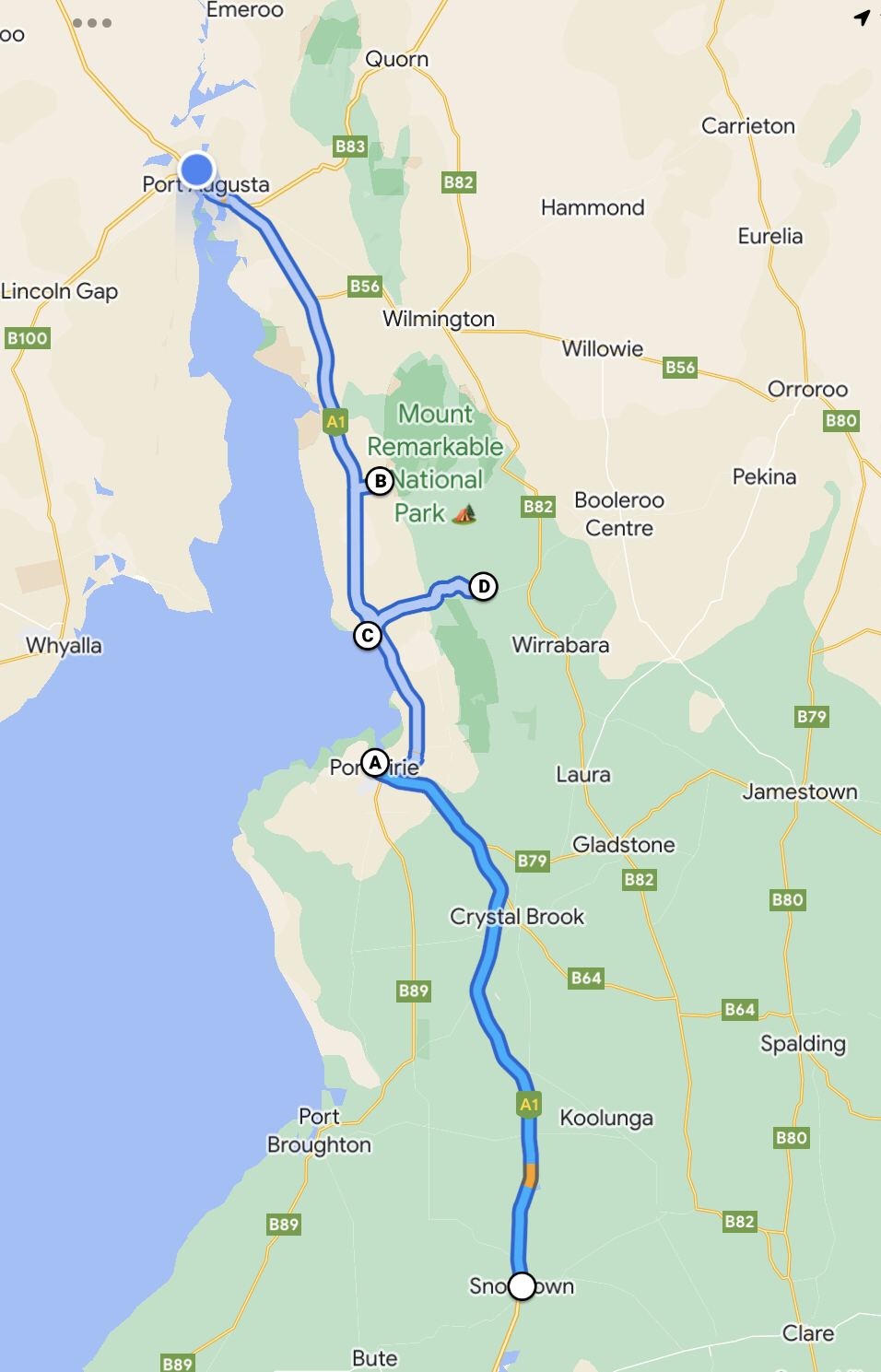
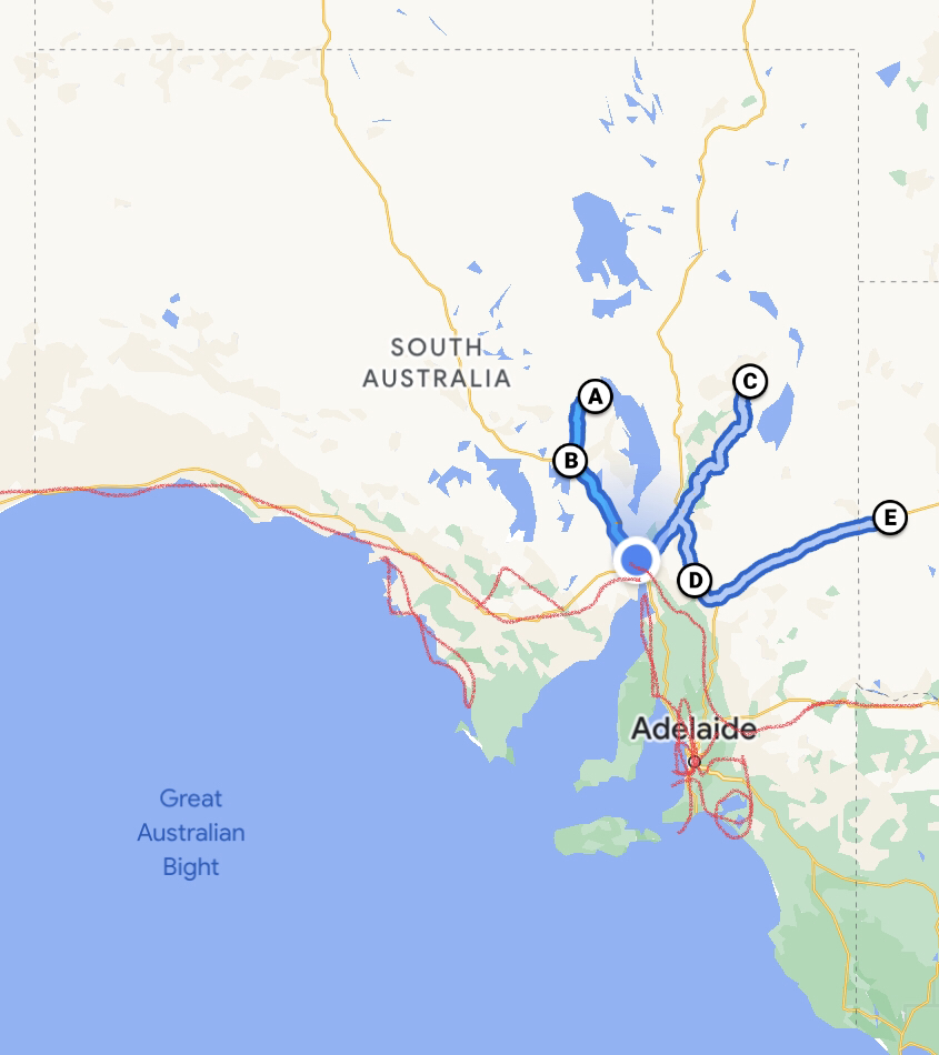
I don't know why I imagined there was industrial sprawl right along the coast between Adelaide and Port Augusta, or that Port Pirie wouldn't have coped with its air pollution problems at the same time as Sydney and Wollongong did! Most of the space is still rural and the geography of this part of South Australia is fascinating. The area is difficult to describe because it divides both between east and west and between north and south, despite being roughly only 300 x 30 kms. A narrow coastal plain runs up the east side of the Spencer Gulf and gives onto a series of flat beaches with no surf and extreme tidal ranges. On the east is bounded by the rolling Mount Lofty Range and the south Flinders Range, with its bands of rock and ever-diminishing tree cover. The other divide is provided by the Goyder Line, which passes across the plain (through Mount Remarkable) and marks where the annual rainfall is 250mm, thus dividing South Australia into those parts which are suitable for cropping and those that are not. Here are some photographs taken along the way. Nights 247&248 - Port Pirie Beach Caravan Park (1A). Situated on a river with a small beach, Port Pirie still has its lead smelter and wheat silos. It also has historic buildings and civic pride. I met a fellow artist who chatted with me about the time he spent with the greats of Broken Hill, Jack (Absolem) and Pro (Hart). Nights 249-251 - Baroota Ruins Campground (1B). Mount Remarkable National Park. Situated on the wrong side of Goyder's Line, Baroota Station did not survive for long. It's not possible to go far into the park without driving and what was most enjoyable were the old pre-invasion river red gums living with burnt or eaten out trunks (see this video). Night 252 - Port Germein Caravan Park (1C). Port Germein is truly a remnant from the past. It has an extraordinarily long pier which once shipped wool and wheat. I backtracked to Port Germein on the advice of a museum volunteer in Port Pirie to drive up to the top of the range (1D) to see the route taken by bullock carts etc bringing ore and other produce down to the port. Nights 253-255 - Shoreline Caravan Park, Port Augusta. This is where I spent night 126 back in April. Port Augusta is a strange town which I can't quite get my head around. Map two shows the whole state and how Port Augusta is forced to be a travel hub; it doesn't receive that many travellers tho, given that the east, west and two northern routes are into desert. The red lines show where I've been already on this trip and the blue ones where I am headed to: Woomera (2B) and Andamooka (2A) first, the northern Flinders ranges after that, and finally back th Broken Hill in NSW (2E).
0 Comments
Leave a Reply. |
AuthorIn mid 2018 I started recording each night I sleep in Bertha: sometimes just for myself, sometimes to share with friends and other travellers. Archives
February 2024
Categories |
 RSS Feed
