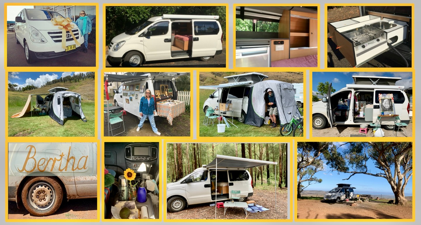
Bertha
|
I thought I might be away for weeks, but I didn't even get as far west as Bathurst. 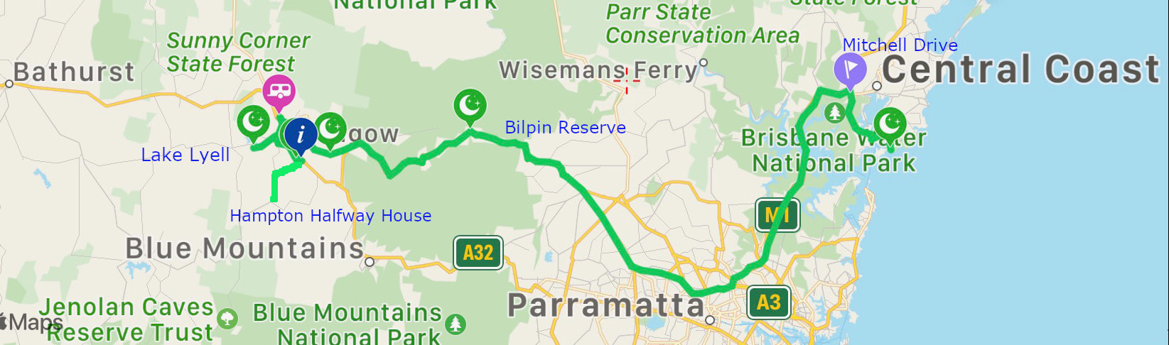
Kariong to Bilpin didn't take too long (crescent second from right/third from left around the middle of the map) The reserve is gazetted as a free overnight stop and a toilet break. It has a small oval beside the highway with half-size soccer nets and a concrete strip for batting practice between them! It's main attraction is that it's right beside the Wollemi National Park; a great place to go for a bushwalking after setting up for the night.
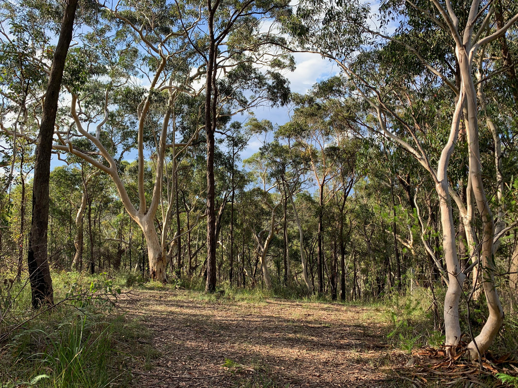
It was an hours drive to Lithgow on Sunday morning where, against expectations but due to the mix of a nice friendly atmosphere, heavy rain and the desire to get some computer work done, I spent three nights in the Lithgow Tourist and Van site (pink caravan to the left of the map). Family run, with goats in the adjoining paddock, this is a good spot to get showered, charge batteries if need be, and fill the waster tank. There was a lot of naīeve art in Lithgow, including an exhibition about Ned Kelly's sister at the local gallery and wall murals showing the mining history of the town. I wasn't sure where I wanted to go next and for Wednesday planned a reconnoitre with a few places in mind. The old village of Hartley (white dotted I on the map) on the Great Western Highway has morphed into a sort of museum campus but would only be good for a short overnight. I didn't want to go as far as Jenolan Caves, but went along the Jenolan Caves Road as far as the Hampton Halfway House before turning back to investigate Little Oaks, the place the that my inlaws used to have. I remembered how often there were campers where the road crosses the Cox's River and was disappointed to find that the place is now more controlled. I came to rest at the Lake Lyell Recreation Park, closer to Lithgow (leftmost crescent moon on the map). This is a reservoir that was built in mid 1980s, and the campground was nice midweek in the rain, but would have been dreadfully crowded with Watersport enthusiasts in the summer. From there I originally planned to go as far west as Bathurst, where I taught in 1971, and use that as point from which to start exploring the Western side of the Great Dividing Range. But by the end of my stay in Lithgow I'd established that my travelling modem wasn't up to the task of handling a Zoom digital video relay I'd committed to doing on Monday, so I decided to head home slowly over the weekend and check out some more potential camping spots on the way. So I headed for the Lockyer's Track Campground (crescent second from the left). It is a leafy parking spot, with lots of space and an only-just-adequate long-drop toilet and with its proximity to the village of Hartley Vale and the 6.2km walking track along one of the earliest roads built in NSW (constructed in 1824 and closed in 1832). I stopped for lunch stop, and while I ate I listened to the latests news bulletin. This finished with the latest weather forecast: Life-threatening storms are approaching. Life-threatening storms are approaching. Immediately the idea of spending two to three days exploring the Blue Mountains campsites seemed less appealing. I didn't drive up to Mount Wilson, where I would have stayed at the Cathedral Reserve Camping Ground, and put that back on the bucket list and pointed Bertha towards home. I drove fast and direct, stopping only for petrol and to take some photos of the bush beginning to recover from the bushfires that swept through fourteen months ago.
0 Comments
Leave a Reply. |
AuthorIn mid 2018 I started recording each night I sleep in Bertha: sometimes just for myself, sometimes to share with friends and other travellers. Archives
May 2024
Categories |
 RSS Feed
